The page text exactly as the engine read it, with the quote marked.
Placed normalised · The quote matches the page once line breaks, hyphenation, case and punctuation are set aside, as the engine's matcher compares text. The marked words are the page's own.
Cultural Resources Literature Review and Phase I Archaeological Survey - Tamsin Ridge
Methods
Plowed fields with good surface visibility were walked at 10-meter intervals (about 610 acres). Hay, pasture and
woods were shovel tested at 15-meter intervals; each shovel test was 50 centimeters across, dug into subsoil
and screened through quarter-inch mesh (1,412 shovel tests). Steep slopes over 15 percent, standing water and
the disturbed mine ground were checked visually. Fieldwork ran from April 24 to June 2, 2023.
Results
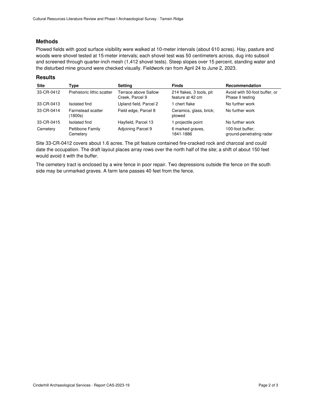
Site Type Setting Finds Recommendation
33-CR-0412 Prehistoric lithic scatter Terrace above Sallow 214 flakes, 3 tools, pit Avoid with 50-foot buffer, or
Creek, Parcel 9 feature at 42 cm Phase II testing
33-CR-0413 Isolated find Upland field, Parcel 2 1 chert flake No further work
33-CR-0414 Farmstead scatter Field edge, Parcel 8 Ceramics, glass, brick; No further work
(1800s) plowed
33-CR-0415 Isolated find Hayfield, Parcel 13 1 projectile point No further work
Cemetery Pettibone Family Adjoining Parcel 9 6 marked graves, 100-foot buffer;
Cemetery 1841-1886 ground-penetrating radar
Site 33-CR-0412 covers about 1.6 acres. The pit feature contained fire-cracked rock and charcoal and could
date the occupation. Quote starts. The draft layout places array rows over the north half of the site; a shift of about 150 feet
would avoid it with the buffer. Quote ends.
The cemetery tract is enclosed by a wire fence in poor repair. Two depressions outside the fence on the south
side may be unmarked graves. A farm lane passes 40 feet from the fence.
Cinderhill Archaeological Services - Report CAS-2023-19 Page 2 of 3
The page
The outline marks where the quote begins on the page.