Skip to content

Preliminary Geotechnical Engineering Report - Tamsin Ridge Solar and Storage Project

C-324cdd0ed0 · Page 1 of 3 · DR-0018 · 2023-05-15

The claim, in the assessor's words

Sinkhole-type subsidence is most likely where cover is under about 100 feet, which applies over the whole undermined area; this is the main geotechnical constraint.

Quoted from page 1
This is the main geotechnical constraint on the Project.

Source consultant_memo · Claim type study_finding · Polarity presence · Confidence high · Quote check exact, 100 of 100

Cited by EN-02 Geotechnical and Soils · Filed under EN-02

On the page

The page text exactly as the engine read it, with the quote marked.

Placed verbatim · The quote occurs on the page exactly as written.

Read as native

Go to the marked quote

Graywacke Geotechnical, LLC Geotechnical engineering and subsurface exploration | Canton, Ohio Preliminary Geotechnical Engineering Report Tamsin Ridge Solar and Storage Project, Harrison Township, Carroll County, Ohio Prepared for Northfold Energy Partners, LLC. Project G23-0219. May 15, 2023. Summary of findings Graywacke drilled 24 borings (B-1 to B-24) across the approximately 1,140-acre Project Area, four of them (B-17 to B-20) to 100 feet in the East Block to investigate mining, and drove and load-tested 30 test piles (TP-1 to TP-30) from March 27 to April 14, 2023. 1. Abandoned underground mine. ODNR Division of Mineral Resources Management abandoned underground mine maps show the Elsby No. 2 Mine, worked in the Upper Freeport (No. 7) coal from about 1915 to 1938 by room-and-pillar methods, beneath approximately 165 acres of the East Block (Parcels 9, 10 and 12). Cover over the coal ranges from 45 to 95 feet. Borings B-17 and B-19 dropped through voids and collapsed rubble at 61 and 74 feet. Two closed depressions, 12 and 20 feet across, on Parcel 10 are mine subsidence features (sinkholes). Pillar failure can continue for decades; sinkhole-type subsidence is most likely where cover is under about 100 feet, which is the case over the whole undermined area. Quote starts. This is the main geotechnical constraint on the Project. Quote ends. 2. Oil and gas wells. Two plugged and abandoned oil and gas wells (Parcels 4 and 10) and an active horizontal Utica well pad adjoining Parcel 5 were located. Keep structures at least 100 feet from plugged wells, and follow the operator's setbacks from the pad and its flowlines. 3. Shallow bedrock and pile refusal. Weathered shale and sandstone were met at 4 to 11 feet. Nine of the 30 test piles (30 percent) met refusal before reaching 8 feet of embedment, mostly on the West Block ridges. Pre-drilling should be assumed for about 30 percent of pile locations. 4. Groundwater. Free water was met at 6 to 14 feet in 9 borings, mostly perched on shale near Sallow Creek. Seasonal high groundwater may be near the surface in the floodplain. 5. Corrosivity. Field resistivity of 1,800 to 3,500 ohm-cm and soil pH of 5.1 to 5.8 indicate moderate corrosivity to buried steel; sulfate exposure is negligible. 6. Slopes. Ground slopes are 0 to 8 percent in the West Block and up to 18 percent in the East Block and on the Sallow Creek valley walls, where colluvium overlies shale. Slope stability is adequate for arrays if cuts on the valley walls are avoided; one small landslide scar was seen on Parcel 12. 7. Design parameters. Frost depth 36 inches. Seismic site class C; seismic hazard is low. Design loads follow ASCE 7-16: basic wind speed 115 mph (Risk Category II), ground snow load 20 psf, and 0.5-inch radial ice for the gen-tie structures. Graywacke Geotechnical, LLC - Project G23-0219 Page 1 of 3

The page

The outline marks where the quote begins on the page.
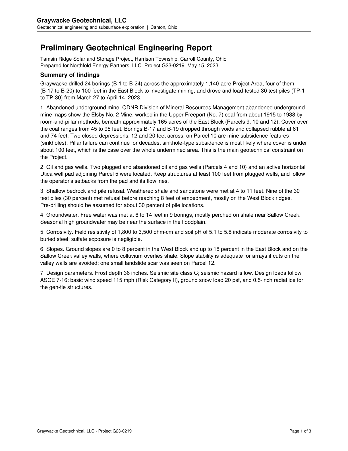
Page 1 of Preliminary Geotechnical Engineering Report - Tamsin Ridge Solar and Storage Project

Other claims quoted on this page

  • C-d106c90db2

    ODNR maps show the abandoned Elsby No. 2 underground coal mine beneath approximately 165 acres of the East Block (Parcels 9, 10 and 12).

  • C-e538cf508c

    Borings B-17 and B-19 dropped through voids and collapsed rubble at 61 and 74 feet.

  • C-e98a4f0f1c

    Two closed depressions on Parcel 10 are mine subsidence features (sinkholes).

  • C-2a9ce2a49f

    Two plugged and abandoned oil and gas wells (Parcels 4 and 10) and an active horizontal Utica well pad adjoining Parcel 5 were located.

  • C-28570f896a

    Structures should be kept at least 100 feet from plugged wells and follow the operator's setbacks from the pad and flowlines.

  • C-e04f4cf7e1

    Weathered shale and sandstone met at 4 to 11 feet; 9 of 30 test piles (30 percent) met refusal before 8 feet embedment, mostly on West Block ridges.

  • C-05146fd25c

    Free water was met at 6 to 14 feet in 9 borings, mostly perched near Sallow Creek; seasonal high groundwater may be near the surface in the floodplain.

  • C-d1c044dc6c

    Resistivity of 1,800 to 3,500 ohm-cm and pH 5.1 to 5.8 indicate moderate corrosivity to buried steel; sulfate exposure is negligible.

  • C-b3cb8c76ac

    Slopes are 0 to 8 percent in the West Block and up to 18 percent in the East Block and Sallow Creek valley walls.

  • C-2b0121cadd

    One small landslide scar was seen on Parcel 12.

  • C-560f40e113

    Seismic site class C; seismic hazard is low.

  • C-4f11de30a3

    Design loads: basic wind speed 115 mph, ground snow load 20 psf, and 0.5-inch radial ice for gen-tie structures.

Lumerian Labs 2026