Up to3Resource is present, likely difficult to address
Evidence
Verified
Cited claims
21
Requirements
0
Requests
1
Rating
2Impacts likely but may be easily resolved
up to3Resource is present, likely difficult to address
The engine shows this rating as 2-3
The rule
Code computed the rating from the assessor's inputs:
impact_likely=yes -> 2
Set by the rule
Decision
Released with flags
The engine's reasons
Agencies not in the register or the evidence: OPSB
Evidence state
Verified · field study or agency determination
Worst case
If what is pending at the cut-off went badly, the same rule gives a higher rating.
Scenario
Investigation finds void-prone shallow-cover ground more widespread than the mapped 165 acres, removing a larger share of the buildable area or requiring extensive grouting.
The assessment is largely well supported, and the category 2 result holds. However, the claim that the mine map is incomplete and may extend west is not backed by the cited quotes, and the worst case relies on it. The 9-acre pad overlap is wording-level.
Revised once after the first critique. Rating unchanged.
The five inputs
Present: yes
Field geotechnical work documents mine-subsidence sinkholes on Parcel 10 (C-e98a4f0f1c) and voids in borings B-17 and B-19 (C-e538cf508c). ODNR records show the abandoned Elsby No. 2 Mine (C-d9db0a1832, C-caad69ed74). Two plugged wells (C-2a9ce2a49f, C-a3cebd779c), a landslide scar (C-2b0121cadd) and hydric soils (C-440f326a24) are also documented. The title absence statement (C-9dcc852809) covers severed mineral estates only. Seismic hazard is low (C-560f40e113), so faults are not an issue. Blasting not expected (C-fd52f76b29) is not a hazard absence.
The undermined area is approximately 165 acres of the East Block (C-d106c90db2), about 21% of 780 buildable acres, so it is localized to the east. Wells are point features (C-2a9ce2a49f) and the landslide scar is small (C-2b0121cadd). Core is arguable given the 20 to 25 MW at stake (C-6a69538071), but the hazard does not underlie most of the site; a mine-void investigation would settle it.
The substation, BESS yard and inverters must not be built over the undermined area (C-f29a379025). Excluding it removes about 165 of 240 fenced East Block acres, roughly 20 to 25 MW (C-6a69538071). Northfold intends to keep it out of the layout (C-44efda80b8). Grouting is the alternative but costs several million dollars and takes 4 to 8 months (C-1efb994b8f). Wells can be set back (C-28570f896a).
The route is engineering investigation and setbacks. OPSB pre-application summary calls for a geotechnical report on the East Block mine (C-eaec90390e). ODNR mine comments are typically made certificate conditions (C-03c910d4d1). No separate individual mine-subsidence approval is documented.
Layout exclusion or grouting of shallow workings is likely (C-6a69538071, C-1efb994b8f). Sinkhole probability is high over shallow workings (C-5c5e675182). Plugged wells need 100-foot structure setbacks and operator setbacks from the pad (C-28570f896a).
Abandoned Elsby No. 2 underground mine lies beneath approximately 165 acres of the East Block; borings hit voids and two mine-subsidence sinkholes are on Parcel 10. Geotechnical consultant rates further sinkhole probability high over shallow workings. Two plugged wells on site; seismic hazard is low.
Critique
Verdict
upheld
Suggested direction for the rating
same
Summary
The assessment is well supported by the cited quotes. Presence, partial avoidability, a standard pathway and a likely impact (category 2) all follow the evidence. Only minor issues: an overreaching statement on faults, an extent judgment call, and a few omitted next steps.
Critic model
Luminol
Issues
Severity minor · Kind unsupported_statement
"Seismic hazard is low, so faults are not an issue" goes beyond C-560f40e113. Low seismic hazard does not show that no faults are present. The row should say faults are unaddressed, or that no fault claim exists.
The extent rationale omits the consultant's statement that the mine is "the main geotechnical constraint on the Project" (C-324cdd0ed0). It also divides the 165 acres by 780 buildable acres, but no claim says the 165 acres lie inside the buildable area. The loss of 20 to 25 MW is roughly 17 to 21% of 120 MW, which supports peripheral. A mine-void investigation or a layout overlay would settle it.
The assessment does not say to coordinate the OPSB-requested geotechnical report (C-eaec90390e) with ODNR mine review. It also leaves out monitoring and repair of the two existing sinkholes on Parcel 10.
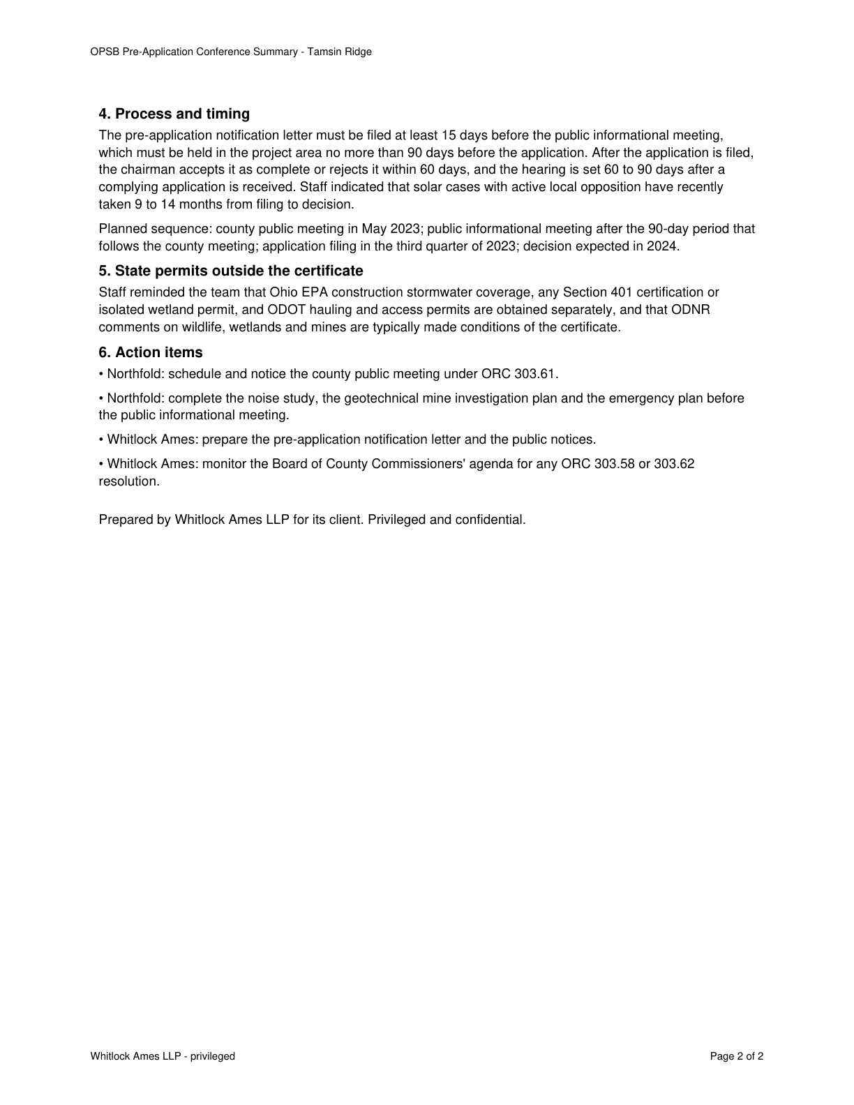
ODNR comments on wildlife, wetlands and mines are typically made conditions of the certificate.
Quote check Exact · Placed normalised · The quote matches the page once line breaks, hyphenation, case and punctuation are set aside, as the engine's matcher compares text. The marked words are the page's own. · Read as native
OPSB Pre-Application Conference Summary - Tamsin Ridge
4. Process and timing
The pre-application notification letter must be filed at least 15 days before the public informational meeting,
which must be held in the project area no more than 90 days before the application. After the application is filed,
the chairman accepts it as complete or rejects it within 60 days, and the hearing is set 60 to 90 days after a
complying application is received. Staff indicated that solar cases with active local opposition have recently
taken 9 to 14 months from filing to decision.
Planned sequence: county public meeting in May 2023; public informational meeting after the 90-day period that
follows the county meeting; application filing in the third quarter of 2023; decision expected in 2024.
5. State permits outside the certificate
Staff reminded the team that Ohio EPA construction stormwater coverage, any Section 401 certification or
isolated wetland permit, and ODOT hauling and access permits are obtained separately, and that Quote starts. ODNR
comments on wildlife, wetlands and mines are typically made conditions of the certificate. Quote ends.
6. Action items
• Northfold: schedule and notice the county public meeting under ORC 303.61.
• Northfold: complete the noise study, the geotechnical mine investigation plan and the emergency plan before
the public informational meeting.
• Whitlock Ames: prepare the pre-application notification letter and the public notices.
• Whitlock Ames: monitor the Board of County Commissioners' agenda for any ORC 303.58 or 303.62
resolution.
Prepared by Whitlock Ames LLP for its client. Privileged and confidential.
Whitlock Ames LLP - privileged Page 2 of 2
The outline marks where the quote begins on the page.
C-03c910d4d1
ODNR comments on wildlife, wetlands and mines are typically made conditions of the certificate.
Quoted from page 2
ODNR comments on wildlife, wetlands and mines are typically made conditions of the certificate.
Sinkhole-type subsidence is most likely where cover is under about 100 feet, which applies over the whole undermined area; this is the main geotechnical constraint.
Quoted from page 1
This is the main geotechnical constraint on
the Project.
Graywacke considers the probability of further sinkholes over the operating life to be high over the shallow workings; the mine map is incomplete and true limit may reach further west.
Quoted from page 2
Graywacke considers the probability of further
sinkholes over the operating life of the Project to be high over the shallow workings.
Records show abandoned underground Elsby No. 2 Mine beneath the eastern part of the project area, plus pre-1977 reclaimed surface mining.
Quoted from page 1
Division records show abandoned underground coal mining, the Elsby No. 2 Mine in the Upper Freeport (No. 7)
coal, beneath the eastern part of the project area
The requirements the assessor tied to this row, by level. Each quote from dated law is shown with its source.
No requirement is tied to this row.
Information requests
IR-66c5dc2424 · Medium priority
Provide the karst, mine or oil and gas well mapping for the project area, or confirm none exists.
Missing evidence
Karst, mine or oil and gas well mapping
Consequence
Geotechnical and Soils is rated on partial evidence without it.
Blocks the decision
No
Raised by
completeness
Next steps
Keep the undermined area out of the layout, with no substation, BESS or inverters over it; commission a mine-void investigation to confirm its limits.
Survey, fence and set back plugged wells; coordinate pad setbacks with the operator and ODNR.
Compare grouting cost against capacity loss.
Agencies
ODNR
OPSB
Cost and impact
Impact
C, S
Potential cost level
M-H
Why
Grouting typically costs several million dollars and takes 4 to 8 months (C-1efb994b8f). Excluding the area loses roughly 20 to 25 MW (C-6a69538071). Further geotechnical investigation and well setbacks add cost.
Impact: C = cost, S = schedule. Potential cost level: L, L-M, M, M-H, H (relative to a utility-scale solar budget).
Comments
Abandoned Elsby No. 2 underground mine lies beneath approximately 165 acres of the East Block; borings hit voids and two mine-subsidence sinkholes are on Parcel 10. Geotechnical consultant rates further sinkhole probability high over shallow workings. Two plugged wells on site; seismic hazard is low.