Tamsin Ridge Solar and Storage
This is a fictional demonstration project in which every organisation, person, parcel and finding is invented.
Wetland and Stream Delineation Report - Tamsin Ridge Solar and Storage Project
C-3d096bbe0e · Page 1 of 3 · DR-0013 · 2023-05-22
The claim, in the assessor's words
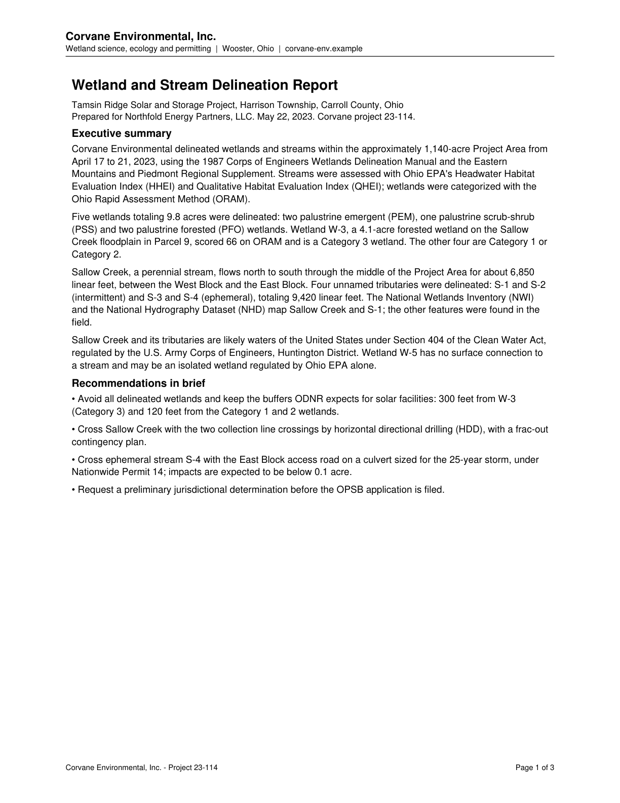
Wetland W-3, a 4.1-acre forested wetland on the Sallow Creek floodplain in Parcel 9, is a Category 3 wetland (ORAM 66).
Wetland W-3, a 4.1-acre forested wetland on the Sallow Creek floodplain in Parcel 9, scored 66 on ORAM and is a Category 3 wetland.
Source field_study · Claim type presence · Polarity presence · Confidence high · Quote check exact, 100 of 100
Cited by AQ-01 Wetlands and Waterbodies · Filed under AQ-01, AQ-02
On the page
The page text exactly as the engine read it, with the quote marked.
Placed normalised · The quote matches the page once line breaks, hyphenation, case and punctuation are set aside, as the engine's matcher compares text. The marked words are the page's own.
Read as native
The page
The outline marks where the quote begins on the page.
Other claims quoted on this page
Five wetlands totaling 9.8 acres were delineated in the Project Area: two PEM, one PSS and two PFO.
Sallow Creek, a perennial stream, flows through the middle of the Project Area for about 6,850 linear feet.
Four unnamed tributaries were delineated (two intermittent, two ephemeral), totaling 9,420 linear feet.
Wetland W-5 has no surface connection to a stream and may be an isolated wetland regulated by Ohio EPA alone.
Recommended to avoid all delineated wetlands with ODNR-expected buffers: 300 feet from W-3 and 120 feet from Category 1 and 2 wetlands.
Cross ephemeral stream S-4 with the East Block access road on a culvert under Nationwide Permit 14, with impacts expected below 0.1 acre.
A preliminary jurisdictional determination should be requested before the OPSB application is filed.