Skip to content

Wetlands and Waterbodies

AQ-01 · Matrix · Aquatic Resources

Rating
3Resource is present, likely difficult to address
Why
Core of the site; partly avoidable
Worst case
Not above the rating
Evidence
Verified
Cited claims
20
Requirements
3
Requests
2

Rating

3Resource is present, likely difficult to address

The engine shows this rating as 3

The rule

Code computed the rating from the assessor's inputs:

extent=core, avoidable=partly -> 3

Set by the rule

Decision
Released
Evidence state
Verified · field study or agency determination

Worst case

The same rule on the worst case gives no rating above the point.

Scenario

Final layout or HDD work affects W-3 or its 300-foot buffer, requiring Ohio EPA individual review and compensatory mitigation with a schedule effect of six months or more.

Step still pending
Preliminary jurisdictional determination and final design
Inputs in the worst case
Extent core · Avoidable partly · Pathway individual · Impact likely yes
The rule on the worst case
worst case (extent=core, avoidable=partly -> 3) not above the point

Revision

Not revised.

The five inputs

Comments

Sallow Creek, perennial, flows through the middle of the Project Area for about 6,850 linear feet. Five wetlands delineated, including Category 3 wetland W-3. Draft layout avoids wetlands; HDD planned for creek crossings and one ephemeral crossing under Nationwide Permit 14. ODNR recommends a 300-foot buffer on W-3.

Critique

Verdict
upheld
Suggested direction for the rating
same
Summary

Core extent and 'partly' avoidability are well supported by field study and agency quotes. Category 3 holds. Only minor problems: an unsupported HDD-permit statement, muddled avoidability wording, and a few omitted next steps. The worst case is grounded in cited claims.

Critic model
Luminol

Issues

  1. Severity minor · Kind unsupported_statement

    "HDD crossings need no permit absent frac-out" is not in C-67f16faf2c, which only says two ~900 ft HDD bores are planned. It is regulatory inference, not quoted. Attribute it, or add a next step to confirm with USACE whether Section 10 or 404 applies.

    Cites C-67f16faf2c

  2. Severity minor · Kind other

    The avoidable rationale says the Sallow Creek crossings are "not avoidable", yet HDD is itself a avoidance method. The S-4 culvert is the only planned fill. The 'partly' rating is defensible, but the wording is muddled. Final design would settle it.

    Cites C-67f16faf2c, C-336bf30d1a

  3. Severity minor · Kind unsupported_statement

    The impact_likely rationale cites the S-2 Dunmore Road culvert load rating (C-fe62671132). That claim does not show any new effect on waters. The S-4 culvert supports 'yes' on its own.

    Cites C-fe62671132

  4. Severity minor · Kind missing_next_step

    Next steps omit confirming which NWP fits the collection and access crossings (NWP 14 versus a solar NWP). They also omit confirming that Ohio EPA's general 401 certification terms are met, and they leave out OPSB coordination. The in-water window is an ODNR recommendation, not a requirement.

    Cites C-ee75dcde7f, C-8b50a6949e

Checks

  • Passed

    rating_has_evidence · blocking

  • Passed

    presence_is_evidenced · not blocking

  • Passed

    counter_evidence_considered · not blocking

  • Passed

    numbers_grounded · not blocking

  • Passed

    agencies_grounded · not blocking

  • Passed

    cutoff_respected · blocking

  • Passed

    critic_not_refuted · blocking

Evidence (20)

Each claim the row cites: the statement in the assessor's words, then the quote the engine found on the page.

Arrow keys move the selection. A middle-click opens the claim's own page.

  1. The May 8, 2023 draft layout avoids all five wetlands and keeps the ODNR buffers.Wetland and Stream Delineation Report - Tamsin Ridge Solar and Storage Project · Page 3Exact
  2. The SFHA follows Sallow Creek through the middle of the property.Standard Flood Hazard Determination - Tamsin Ridge Parcels 5, 9 and 10 · Page 1Exact
  3. The S-4 access road crossing is the only planned fill: about 40 linear feet of ephemeral channel (0.02 acre) under NWP 14.Wetland and Stream Delineation Report - Tamsin Ridge Solar and Storage Project · Page 3Exact
  4. Wetland W-3, a 4.1-acre forested wetland on the Sallow Creek floodplain in Parcel 9, is a Category 3 wetland (ORAM 66).Wetland and Stream Delineation Report - Tamsin Ridge Solar and Storage Project · Page 1Exact
  5. A USACE nationwide permit is expected for one access road crossing of an ephemeral stream.Tamsin Ridge Solar and Storage Project - Project Description · Page 1Exact
  6. Any impact to a Category 3 wetland needs Ohio EPA's individual review, and filling an isolated wetland needs an Ohio EPA permit.Wetland and Stream Delineation Report - Tamsin Ridge Solar and Storage Project · Page 3Exact
  7. If W-3 or its 300-foot buffer is affected, Ohio EPA individual review and compensatory mitigation would be needed, with a schedule effect of six months or more.Wetland and Stream Delineation Report - Tamsin Ridge Solar and Storage Project · Page 3Exact
  8. Two collection line crossings of Sallow Creek are planned as HDD bores of about 900 feet, needing no permit absent frac-out.Wetland and Stream Delineation Report - Tamsin Ridge Solar and Storage Project · Page 3Exact
  9. Recommended to avoid all delineated wetlands with ODNR-expected buffers: 300 feet from W-3 and 120 feet from Category 1 and 2 wetlands.Wetland and Stream Delineation Report - Tamsin Ridge Solar and Storage Project · Page 1Exact
  10. Sallow Creek is not on Ohio EPA's impaired waters list and no TMDL applies.Stormwater, Floodplain and Drainage Memo - Tamsin Ridge Solar and Storage Project · Page 1Exact
  11. Sallow Creek, a perennial stream, flows through the middle of the Project Area for about 6,850 linear feet.Wetland and Stream Delineation Report - Tamsin Ridge Solar and Storage Project · Page 1Exact
  12. Cross ephemeral stream S-4 with the East Block access road on a culvert under Nationwide Permit 14, with impacts expected below 0.1 acre.Wetland and Stream Delineation Report - Tamsin Ridge Solar and Storage Project · Page 1Exact
  13. A preliminary jurisdictional determination should be requested before the OPSB application is filed.Wetland and Stream Delineation Report - Tamsin Ridge Solar and Storage Project · Page 1Exact
  14. Five wetlands totaling 9.8 acres were delineated in the Project Area: two PEM, one PSS and two PFO.Wetland and Stream Delineation Report - Tamsin Ridge Solar and Storage Project · Page 1Exact
  15. The Division recommends HDD for collection crossings of Sallow Creek and avoiding the Category 3 wetland with a 300-foot buffer.ODNR Environmental Review - Tamsin Ridge Solar and Storage Project (ODNR 23-0477) · Page 1Exact
  16. Upland data points in the cropland showed no hydric indicators.Wetland and Stream Delineation Report - Tamsin Ridge Solar and Storage Project · Page 2Exact
  17. Riparian forest lines most of Sallow Creek's length.Wetland and Stream Delineation Report - Tamsin Ridge Solar and Storage Project · Page 2Exact
  18. Four unnamed tributaries were delineated (two intermittent, two ephemeral), totaling 9,420 linear feet.Wetland and Stream Delineation Report - Tamsin Ridge Solar and Storage Project · Page 1Exact
  19. Sallow Creek supports a diverse fish assemblage, and no in-water work is recommended April 15 to June 30.ODNR Environmental Review - Tamsin Ridge Solar and Storage Project (ODNR 23-0477) · Page 1Exact
  20. A stream designated S-2 is crossed by Dunmore Road, and Sallow Creek is crossed by Linnet Road.Haul Route Review Comments - Tamsin Ridge Solar and Storage Project · Page 1Exact

Wetland and Stream Delineation Report - Tamsin Ridge Solar and Storage Project

C-13ca79b38e · Page 3 of 3 · DR-0013

Open the claim, C-13ca79b38e

The May 8, 2023 draft layout avoids all five wetlands and keeps the ODNR buffers.

Quote check Exact · Placed verbatim · The quote occurs on the page exactly as written. · Read as native

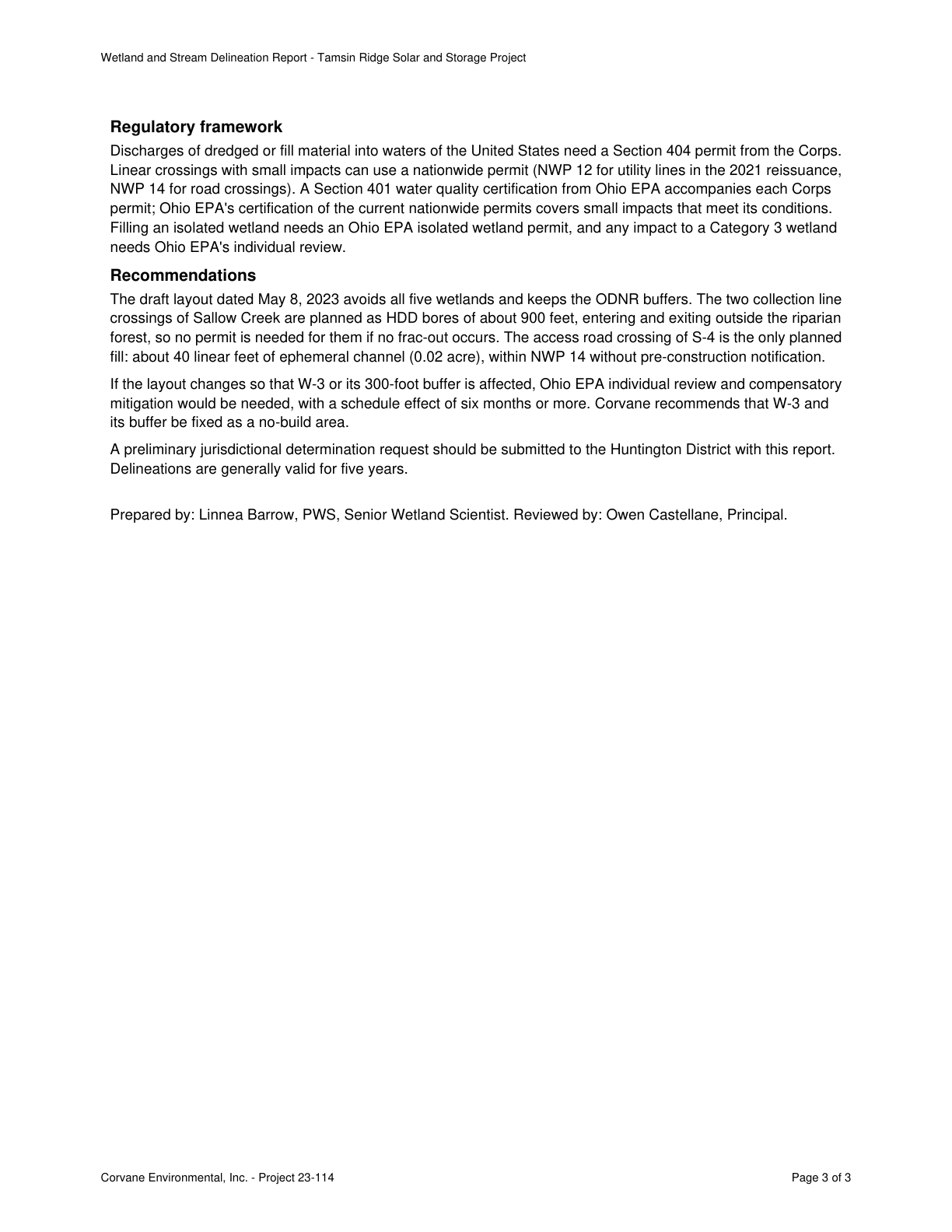
Wetland and Stream Delineation Report - Tamsin Ridge Solar and Storage Project Regulatory framework Discharges of dredged or fill material into waters of the United States need a Section 404 permit from the Corps. Linear crossings with small impacts can use a nationwide permit (NWP 12 for utility lines in the 2021 reissuance, NWP 14 for road crossings). A Section 401 water quality certification from Ohio EPA accompanies each Corps permit; Ohio EPA's certification of the current nationwide permits covers small impacts that meet its conditions. Filling an isolated wetland needs an Ohio EPA isolated wetland permit, and any impact to a Category 3 wetland needs Ohio EPA's individual review. Recommendations Quote starts. The draft layout dated May 8, 2023 avoids all five wetlands and keeps the ODNR buffers. Quote ends. The two collection line crossings of Sallow Creek are planned as HDD bores of about 900 feet, entering and exiting outside the riparian forest, so no permit is needed for them if no frac-out occurs. The access road crossing of S-4 is the only planned fill: about 40 linear feet of ephemeral channel (0.02 acre), within NWP 14 without pre-construction notification. If the layout changes so that W-3 or its 300-foot buffer is affected, Ohio EPA individual review and compensatory mitigation would be needed, with a schedule effect of six months or more. Corvane recommends that W-3 and its buffer be fixed as a no-build area. A preliminary jurisdictional determination request should be submitted to the Huntington District with this report. Delineations are generally valid for five years. Prepared by: Linnea Barrow, PWS, Senior Wetland Scientist. Reviewed by: Owen Castellane, Principal. Corvane Environmental, Inc. - Project 23-114 Page 3 of 3

The outline marks where the quote begins on the page.
Page 3 of Wetland and Stream Delineation Report - Tamsin Ridge Solar and Storage Project
  1. C-13ca79b38e

    The May 8, 2023 draft layout avoids all five wetlands and keeps the ODNR buffers.

    Quoted from page 3
    The draft layout dated May 8, 2023 avoids all five wetlands and keeps the ODNR buffers.

    Wetland and Stream Delineation Report - Tamsin Ridge Solar and Storage Project · DR-0013 · Page 3 · 2023-05-22

    Source developer_document · Claim type other · Polarity neutral · Confidence high · Quote check exact, 100 of 100

    Cited by PE-03 · Filed under AQ-01, PE-02, PE-03

  2. C-29b335e462

    The SFHA follows Sallow Creek through the middle of the property.

    Quoted from page 1
    The special flood hazard area (SFHA) follows Sallow Creek through the middle of the property.

    Standard Flood Hazard Determination - Tamsin Ridge Parcels 5, 9 and 10 · DR-0009 · Page 1 · 2023-03-15

    Source agency_determination · Claim type presence · Polarity presence · Confidence medium · Quote check exact, 100 of 100

    Cited by AQ-02

  3. C-336bf30d1a

    The S-4 access road crossing is the only planned fill: about 40 linear feet of ephemeral channel (0.02 acre) under NWP 14.

    Quoted from page 3
    about 40 linear feet of ephemeral channel (0.02 acre), within NWP 14 without pre-construction notification.

    Wetland and Stream Delineation Report - Tamsin Ridge Solar and Storage Project · DR-0013 · Page 3 · 2023-05-22

    Source consultant_memo · Claim type extent · Polarity presence · Confidence high · Quote check exact, 100 of 100

    Cited by EG-01, PE-03 · Filed under AQ-01, EG-01, PE-03

  4. C-3d096bbe0e

    Wetland W-3, a 4.1-acre forested wetland on the Sallow Creek floodplain in Parcel 9, is a Category 3 wetland (ORAM 66).

    Quoted from page 1
    Wetland W-3, a 4.1-acre forested wetland on the Sallow Creek floodplain in Parcel 9, scored 66 on ORAM and is a Category 3 wetland.

    Wetland and Stream Delineation Report - Tamsin Ridge Solar and Storage Project · DR-0013 · Page 1 · 2023-05-22

    Source field_study · Claim type presence · Polarity presence · Confidence high · Quote check exact, 100 of 100

    Filed under AQ-01, AQ-02

  5. C-441acfa155

    A USACE nationwide permit is expected for one access road crossing of an ephemeral stream.

    Quoted from page 1
    A U.S. Army Corps of Engineers nationwide permit is expected for one access road crossing of an ephemeral stream.

    Tamsin Ridge Solar and Storage Project - Project Description · DR-0001 · Page 1 · 2023-06-12

    Source developer_document · Claim type presence · Polarity presence · Confidence high · Quote check exact, 100 of 100

    Cited by EC-01, PE-03 · Filed under AQ-01, PE-03

  6. C-4a94b88b6a

    Any impact to a Category 3 wetland needs Ohio EPA's individual review, and filling an isolated wetland needs an Ohio EPA permit.

    Quoted from page 3
    Filling an isolated wetland needs an Ohio EPA isolated wetland permit, and any impact to a Category 3 wetland

    Wetland and Stream Delineation Report - Tamsin Ridge Solar and Storage Project · DR-0013 · Page 3 · 2023-05-22

    Source consultant_memo · Claim type regulatory · Polarity presence · Confidence medium · Quote check exact, 100 of 100

    Filed under AQ-01, PE-02, PE-03

  7. C-65f000df43

    If W-3 or its 300-foot buffer is affected, Ohio EPA individual review and compensatory mitigation would be needed, with a schedule effect of six months or more.

    Quoted from page 3
    Ohio EPA individual review and compensatory mitigation would be needed, with a schedule effect of six months or more.

    Wetland and Stream Delineation Report - Tamsin Ridge Solar and Storage Project · DR-0013 · Page 3 · 2023-05-22

    Source consultant_memo · Claim type schedule · Polarity presence · Confidence high · Quote check exact, 100 of 100

    Filed under AQ-01, PE-02, PE-03

  8. C-67f16faf2c

    Two collection line crossings of Sallow Creek are planned as HDD bores of about 900 feet, needing no permit absent frac-out.

    Quoted from page 3
    The two collection line crossings of Sallow Creek are planned as HDD bores of about 900 feet,

    Wetland and Stream Delineation Report - Tamsin Ridge Solar and Storage Project · DR-0013 · Page 3 · 2023-05-22

    Source consultant_memo · Claim type other · Polarity neutral · Confidence medium · Quote check exact, 100 of 100

    Filed under AQ-01, PE-03

  9. C-786ca1992e

    Recommended to avoid all delineated wetlands with ODNR-expected buffers: 300 feet from W-3 and 120 feet from Category 1 and 2 wetlands.

    Quoted from page 1
    Avoid all delineated wetlands and keep the buffers ODNR expects for solar facilities: 300 feet from W-3

    Wetland and Stream Delineation Report - Tamsin Ridge Solar and Storage Project · DR-0013 · Page 1 · 2023-05-22

    Source consultant_memo · Claim type recommendation · Polarity neutral · Confidence high · Quote check exact, 100 of 100

    Filed under AQ-01, EC-03

  10. C-846e2b0e13

    Sallow Creek is not on Ohio EPA's impaired waters list and no TMDL applies.

    Quoted from page 1
    Sallow Creek is not on Ohio EPA's list of impaired waters and no TMDL applies to it.

    Stormwater, Floodplain and Drainage Memo - Tamsin Ridge Solar and Storage Project · DR-0019 · Page 1 · 2023-06-05

    Source consultant_memo · Claim type absence · Polarity absence · Confidence high · Quote check exact, 100 of 100

    Cited by EG-02 · Filed under AQ-01, EG-02

  11. C-8644116b06

    Sallow Creek, a perennial stream, flows through the middle of the Project Area for about 6,850 linear feet.

    Quoted from page 1
    Sallow Creek, a perennial stream, flows north to south through the middle of the Project Area for about 6,850

    Wetland and Stream Delineation Report - Tamsin Ridge Solar and Storage Project · DR-0013 · Page 1 · 2023-05-22

    Source field_study · Claim type presence · Polarity presence · Confidence high · Quote check exact, 100 of 100

  12. C-8b50a6949e

    Cross ephemeral stream S-4 with the East Block access road on a culvert under Nationwide Permit 14, with impacts expected below 0.1 acre.

    Quoted from page 1
    under Nationwide Permit 14; impacts are expected to be below 0.1 acre.

    Wetland and Stream Delineation Report - Tamsin Ridge Solar and Storage Project · DR-0013 · Page 1 · 2023-05-22

    Source consultant_memo · Claim type recommendation · Polarity neutral · Confidence high · Quote check exact, 100 of 100

    Cited by PE-03 · Filed under AQ-01, PE-02, PE-03

  13. C-8deff0ea95

    A preliminary jurisdictional determination should be requested before the OPSB application is filed.

    Quoted from page 1
    Request a preliminary jurisdictional determination before the OPSB application is filed.

    Wetland and Stream Delineation Report - Tamsin Ridge Solar and Storage Project · DR-0013 · Page 1 · 2023-05-22

    Source consultant_memo · Claim type recommendation · Polarity neutral · Confidence high · Quote check exact, 100 of 100

    Cited by PE-03 · Filed under AQ-01, PE-03

  14. C-a0386d398c

    Five wetlands totaling 9.8 acres were delineated in the Project Area: two PEM, one PSS and two PFO.

    Quoted from page 1
    Five wetlands totaling 9.8 acres were delineated: two palustrine emergent (PEM), one palustrine scrub-shrub

    Wetland and Stream Delineation Report - Tamsin Ridge Solar and Storage Project · DR-0013 · Page 1 · 2023-05-22

    Source field_study · Claim type presence · Polarity presence · Confidence high · Quote check exact, 100 of 100

  15. C-c98dca4336

    The Division recommends HDD for collection crossings of Sallow Creek and avoiding the Category 3 wetland with a 300-foot buffer.

    Quoted from page 1
    The Division recommends HDD for collection crossings of Sallow Creek and avoidance of the Category 3 wetland with a 300-foot buffer.

    ODNR Environmental Review - Tamsin Ridge Solar and Storage Project (ODNR 23-0477) · DR-0011 · Page 1 · 2023-05-02

    Source agency_determination · Claim type presence · Polarity presence · Confidence high · Quote check exact, 100 of 100

  16. C-cfe8567236

    Upland data points in the cropland showed no hydric indicators.

    Quoted from page 2
    Upland data points in the cropland showed no hydric indicators.

    Wetland and Stream Delineation Report - Tamsin Ridge Solar and Storage Project · DR-0013 · Page 2 · 2023-05-22

    Source field_study · Claim type absence · Polarity absence · Confidence high · Quote check exact, 100 of 100

  17. C-e10af45ca9

    Riparian forest lines most of Sallow Creek's length.

    Quoted from page 2
    Riparian forest lines most of its length.

    Wetland and Stream Delineation Report - Tamsin Ridge Solar and Storage Project · DR-0013 · Page 2 · 2023-05-22

    Source field_study · Claim type presence · Polarity presence · Confidence medium · Quote check exact, 100 of 100

    Cited by EC-03 · Filed under AQ-01, EC-03

  18. C-e5bfe1d5f5

    Four unnamed tributaries were delineated (two intermittent, two ephemeral), totaling 9,420 linear feet.

    Quoted from page 1
    Four unnamed tributaries were delineated: S-1 and S-2

    Wetland and Stream Delineation Report - Tamsin Ridge Solar and Storage Project · DR-0013 · Page 1 · 2023-05-22

    Source field_study · Claim type presence · Polarity presence · Confidence high · Quote check exact, 100 of 100

  19. C-ee75dcde7f

    Sallow Creek supports a diverse fish assemblage, and no in-water work is recommended April 15 to June 30.

    Quoted from page 1
    Sallow Creek supports a diverse fish assemblage. No in-water work is recommended from April 15 to June 30.

    ODNR Environmental Review - Tamsin Ridge Solar and Storage Project (ODNR 23-0477) · DR-0011 · Page 1 · 2023-05-02

    Source agency_determination · Claim type presence · Polarity presence · Confidence high · Quote check exact, 100 of 100

    Filed under AQ-01, EC-02

  20. C-fe62671132

    A stream designated S-2 is crossed by Dunmore Road, and Sallow Creek is crossed by Linnet Road.

    Quoted from page 1
    The Dunmore Road culvert at stream S-2 must be load-rated by the applicant's engineer before use.

    Haul Route Review Comments - Tamsin Ridge Solar and Storage Project · DR-0029 · Page 1 · 2023-07-05

    Source agency_determination · Claim type presence · Polarity presence · Confidence low · Quote check exact, 100 of 100

Requirements and permits

The requirements the assessor tied to this row, by level. Each quote from dated law is shown with its source.

Federal

  • Section 404 permit (Nationwide Permit, e.g. NWP 51, or Individual Permit)

    F-CWA404 · U.S. Army Corps of Engineers (district by location)

    Applicability
    Conditional
    Instrument
    Clean Water Act Section 404 (33 U.S.C. 1344); 33 CFR Parts 320-332
    Trigger
    Fill or discharge in jurisdictional waters or wetlands (roads, crossings, grading).
    Description

    Regulates discharge of dredged or fill material into waters of the United States, including wetlands. Permit type depends on the area of impact and the activity. NWP 51 (land-based renewable energy) allows the loss of up to 1/2 acre of non-tidal waters, with pre-construction notification above 1/10 acre.

    Typical timeline

    NWP with a pre-construction notification: the permittee may presume the project qualifies unless the Corps responds within a 45-day period that starts on receipt of the notification (33 CFR 330.1(e)(1)); listed-species and historic-property clearances (see the Endangered Species Act and Section 106 rows) can hold authorization longer. Individual permit: decision target of 60 days after receipt of a complete application, subject to the exceptions in 33 CFR 325.2(d)(3). Typical: 2 to 4 months for an NWP with notification and 6 to 12 months or more for an individual permit (basis: practice, not stated in the sources).

    Version of the law on the cut-off
    33 CFR 330 as amended in 2022
    As of the cut-off

    As of the cut-off: The 16 NWPs reissued or issued in January 2021, including NWP 51 for land-based renewable energy, and the 32 general conditions took effect (86 FR 2744). (2021-03-15) A federal district court in Arizona (Pascua Yaqui Tribe v. EPA) vacated the 2020 Navigable Waters Protection Rule; from 2021-09-03 the agencies applied the pre-2015 regulatory definition of waters of the United States, read in light of Rapanos. (2021-08-30) The remaining 41 NWPs took effect under the same general conditions (86 FR 73522). (2022-02-25) A federal district court in Texas (Texas v. EPA, S.D. Tex.) preliminarily enjoined the 2023 rule in Texas and Idaho, where the agencies continued to apply the pre-2015 regulatory regime. (2023-03-19) The 2023 rule revising the definition of waters of the United States (88 FR 3004) took effect, but was not operative in some states because of litigation. (2023-03-20) A federal court in North Dakota enjoined the 2023 rule in the 24 plaintiff states, which include Virginia (West Virginia v. EPA). (2023-04-12) Sackett v. EPA narrowed the scope of waters of the United States. (2023-05-25) Announced by the cut-off, taking effect later (not applied): The 2021 NWPs, including NWP 51, expire; verification letters generally expire on the same date. (2026-03-14; announced 2021-01-13)

    Verification
    PACK_PENDING_QUALIFIED_REVIEW
    Source
    pack:federal
    In the permit matrix
    F-CWA404
    Legal basis: 4 quotes from dated law
    Quoted from the law, page 1
    Except as provided in § 323.4 of this part, DA permits will be required for the discharge of dredged or fill material into waters of the United States. Certain discharges specified in 33 CFR part 330 are permitted by that regulation (“nationwide permits”).

    Source 33CFR323 · page 1 · version 2023-08-01

    Cited for requirement and trigger

    In force from 2016-12-15 to 2026-10-07

    eCFR versioner: 33 CFR part 323, same text on 2021-10-15, 2022-05-20, 2022-09-12, 2023-04-22, 2023-08-01 and on every amendment date between them; amendment dates 2016-12-15

    May be cited on the cut-off date.

    Quoted from the law, page 1
    The permittee may presume that his project qualifies for the NWP unless he is otherwise notified by the DE within a 45-day period. The 45-day period starts on the date of receipt of the notification in the Corps district office and ends 45 calendar days later regardless of weekends or holidays.

    Source 33CFR330 · page 1 · version 2023-08-01

    Cited for timeline: NWP pre-construction notification

    In force from 2022-03-21 to 2026-10-07

    eCFR versioner: 33 CFR part 330, same text on 2022-05-20, 2022-09-12, 2023-04-22, 2023-08-01 and on every amendment date between them; amendment dates 2016-12-15, 2022-03-07, 2022-03-21

    May be cited on the cut-off date.

    Quoted from the law, page 1
    District engineers will decide on all applications not later than 60 days after receipt of a complete application, unless (i) precluded as a matter of law or procedures required by law (see below)

    Source 33CFR325 · page 1 · version 2023-08-01

    Cited for timeline: individual permit decision target

    In force from 2016-12-15 to 2025-07-02

    eCFR versioner: 33 CFR part 325, same text on 2021-10-15, 2022-05-20, 2022-09-12, 2023-04-22, 2023-08-01 and on every amendment date between them; amendment dates 2016-12-15, 2025-07-03, 2025-07-15

    May be cited on the cut-off date.

    Quoted from the law, page 120
    The discharge must not cause the loss of greater than 1⁄2-acre of non-tidal waters of the United States. This NWP does not authorize discharges of dredged or fill material into non-tidal wetlands adjacent to tidal waters. Notification: The permittee must submit a pre-construction notification to the district engineer prior to commencing the activity if the discharge results in the loss of greater than 1⁄10- acre of waters of the United States.

    Source 86FR2744 · page 120 · version 2021-01-13

    May be cited on the cut-off date.

State

  • Section 401 water quality certification (individual, or coverage under Ohio EPA's general certification of a Corps nationwide permit)

    OH-401 · Ohio Environmental Protection Agency (Ohio EPA), Division of Surface Water (401 Water Quality Certification and Isolated Wetland Permitting Section)

    Applicability
    Conditional
    Instrument
    ORC 6111.03(O) and 6111.30; OAC Chapter 3745-32; Ohio EPA general 401 certification of the 2022 nationwide permits (2021-10-13)
    Trigger
    A federal license or permit (for example a Corps Section 404 permit) for an activity that may result in a discharge of dredged or fill material to a water of the state.
    Description

    Anyone who needs a federal license or permit, such as a Corps Section 404 permit, for an activity that may discharge dredged or fill material to a water of the state must obtain a 401 certification from Ohio EPA before starting. No separate application is needed for a Corps nationwide permit that Ohio EPA has certified, if the project meets the certification's terms and conditions. Ohio EPA's certification of the 2022 nationwide permits carries conditions; for example, Category 3 wetland impacts above 0.1 acre need an individual certification, although Ohio EPA can grant coverage to a project that does not meet a condition (a director's authorization). For the 2021 nationwide permits, listed in the dated events, the Corps notice states that Ohio's certification was waived; confirm the treatment with the Corps district. An individual application must include current Corps correspondence on the jurisdictional status of the waters.

    Typical timeline

    Individual certification: the application is due no later than 45 days after the Corps publishes its 404 public notice, and Ohio EPA acts within 180 days of a complete application. Nationwide permit with an Ohio EPA notification: work may proceed on Ohio EPA's written clearance, or once 45 calendar days have passed from Ohio EPA's receipt of the notification without a request for more information or an individual certification.

    As of the cut-off

    As of the cut-off: The Corps' notice for the 16 nationwide permits that took effect on this date (NWPs 12, 21, 29, 39, 40, 42, 43, 44, 48, 50, 51, 52, 55, 56, 57 and 58, which include NWP 51 for land-based renewable energy and NWP 57 for electric utility lines) states that Ohio's Section 401 certification was waived for them. (2021-03-15) The 41 nationwide permits reissued for 2022 (including NWP 14, linear transportation projects) took effect with Ohio EPA's general Section 401 certification, issued with conditions on 2021-10-13; they expire 2026-03-14. (2022-02-25)

    Verification
    PACK_PENDING_QUALIFIED_REVIEW
    Source
    pack:oh.json
    In the permit matrix
    OH-401
    Legal basis: 8 quotes from dated law
    Quoted from the law, page 5
    Any applicant for a federal license or permit to conduct any activity which may result in a discharge of dredged or fill material to a water of the state shall apply for and obtain a 401 certification from Ohio EPA. (B) No person shall engage in an activity requiring a 401 certification prior to obtaining that certification from Ohio EPA.

    Source OAC 3745 32 section 401 certification · page 5 · version 2023-08-01

    In force from 2017-01-02 to 2024-07-19, section 3745-32-02

    3745-32-02: version effective 2017-01-02; first change after it 2024-07-20 (Ohio EPA five-year review package for OAC 3745-32-01 to -04 (401 water quality certification; comment period 2023-11-03 to 2023-12-08); filing number not retrieved), from codes.ohio.gov version history in archive captures (confirmed_two_sources)

    May be cited on the cut-off date.

    Quoted from the law, page 6
    If the federal permit sought is a nationwide permit, a regional permit, or a letter of permission issued by the corps and Ohio EPA has issued a certification for the federal permit, no further application is required to be submitted to Ohio EPA under this chapter provided that the project meets all of the terms and conditions

    Source OAC 3745 32 section 401 certification · page 6 · version 2023-08-01

    In force from 2017-01-02 to 2024-07-19, section 3745-32-03

    3745-32-03: version effective 2017-01-02; first change after it 2024-07-20 (Ohio EPA five-year review package for OAC 3745-32-01 to -04; filing number not retrieved), from codes.ohio.gov version history in archive captures (confirmed_two_sources)

    May be cited on the cut-off date.

    Quoted from the law, page 7
    The application shall be submitted no later than forty-five days after the publication of the corps 404 public notice, if applicable, and shall include the following: (a) Current and unexpired correspondence from the corps documenting the jurisdictional status of the waters located within the project area.

    Source OAC 3745 32 section 401 certification · page 7 · version 2023-08-01

    In force from 2017-01-02 to 2024-07-19, section 3745-32-03

    3745-32-03: version effective 2017-01-02; first change after it 2024-07-20 (Ohio EPA five-year review package for OAC 3745-32-01 to -04; filing number not retrieved), from codes.ohio.gov version history in archive captures (confirmed_two_sources)

    May be cited on the cut-off date.

    Quoted from the law, page 39
    (G) The director shall issue or deny a section 401 water quality certification not later than one hundred eighty days after the complete application for the certification is received.

    Source ORC 6111 water pollution isolated wetlands 401 · page 39 · version 2023-08-01

    In force from 2021-04-12 to 2026-10-03, section 6111.30

    6111.30: version effective 2021-04-12, still the current version when the page map was checked (2026-10-03)

    May be cited on the cut-off date.

    Quoted from the law, page 5
    D. DIRECTOR’S AUTHORIZATION 1. In accordance with the procedures outlined in Appendix A, Ohio EPA can grant coverage under this certification for any project that does not meet one or more of the terms and conditions for eligibility of this certification or where the district engineer has been granted authority to waive certain requirements.

    Source OEPA 401 WQC for the 2022 Nationwide Permits 41 NWPs Ohio EPA ID 217512 · page 5 · version 2021-10-13

    May be cited on the cut-off date.

    Quoted from the law, page 6
    a. They are notified in writing by Ohio EPA that the activity may proceed under the 401 WQC for the NWP; or b. 45 calendar days have passed from Ohio EPA’s receipt of the notification and the applicant has not received written notice from Ohio EPA that additional information is necessary or that an individual 401 WQC is required.

    Source OEPA 401 WQC for the 2022 Nationwide Permits 41 NWPs Ohio EPA ID 217512 · page 6 · version 2021-10-13

    May be cited on the cut-off date.

    Quoted from the law, page 13
    3. Individual 401 WQC is required for temporary or permanent impacts to category 3 wetlands that exceed 0.1 acres. Impacts to category 3 wetlands are only allowable for activities involving the repair, maintenance, replacement, or safety upgrades to existing infrastructure that meets the definition of public need.

    Source OEPA 401 WQC for the 2022 Nationwide Permits 41 NWPs Ohio EPA ID 217512 · page 13 · version 2021-10-13

    May be cited on the cut-off date.

    Quoted from the law, page 4
    The NWPs are not valid until the appropriate state agency certifies the discharge of dredged or fill material into waters of the U.S. does not violate state water quality standards or waives certification pursuant to 40 CFR § 121.9. The State of Ohio Section 401 Water Quality Certification has been waived for the 2021 NWPs.

    Source Huntington District PN Nationwide Permits for Ohio 16 NWPs regional conditions · page 4 · version 2021-03-15

    May be cited on the cut-off date.

  • State isolated wetland permit for filling an isolated wetland (Level 1 general permit, or Level 2 or Level 3 individual permit)

    OH-IWP · Ohio Environmental Protection Agency (Ohio EPA), Division of Surface Water

    Applicability
    Conditional
    Instrument
    ORC 6111.02 to 6111.028; OAC 3745-1-50 to 3745-1-54; Ohio EPA Level 1 isolated wetland general permit (effective 2022-07-21)
    Trigger
    Filling an isolated wetland, meaning a wetland that is not subject to regulation under the federal Water Pollution Control Act.
    Description

    No one may fill an isolated wetland, meaning a wetland not subject to regulation under the federal Water Pollution Control Act, without an Ohio EPA isolated wetland permit. Review depends on wetland category and acreage. Level 1, a general permit: Category 1 or 2, one-half acre or less. Level 2, an individual permit: Category 1 over one-half acre, or Category 2 over one-half acre up to three acres. Level 3, an individual permit: Category 2 over three acres, or any Category 3. Ohio EPA lists review periods of 30, 90 and 180 days, public notice for Levels 2 and 3, and a mandatory hearing for Category 3. A Level 1 notice needs an ORAM 5.0 form for each wetland and a Corps determination that the wetlands are not waters of the United States; a preliminary jurisdictional determination treats all wetlands as federal.

    Typical timeline

    Ohio EPA review periods: 30 days for a Level 1 general permit, 90 days for a Level 2 individual permit and 180 days for a Level 3 individual permit, as listed on Ohio EPA's program page.

    Version of the law on the cut-off
    As in force from 2023-05-17 (the library text)
    As of the cut-off

    As of the cut-off: Ohio EPA's Level 1 isolated wetland general permit (Category 1 and 2 wetlands, one-half acre or less) took effect and runs to 2027-07-21; it was in force on the cut-off. (2022-07-21) Sackett v. EPA held that the Clean Water Act reaches an adjacent wetland only if it has a continuous surface connection to a relatively permanent water of the United States, so more wetlands can fall outside federal jurisdiction and count as isolated under ORC 6111.02. By 2023-07-20 the federal agencies' implementation page said they would interpret waters of the United States consistent with the decision. (2023-05-25)

    Verification
    PACK_PENDING_QUALIFIED_REVIEW
    Source
    pack:oh.json
    In the permit matrix
    OH-IWP
    Legal basis: 8 quotes from dated law
    Quoted from the law, page 21
    No person shall engage in the filling of an isolated wetland unless authorized to do so by a general or individual state isolated wetland permit.

    Source ORC 6111 water pollution isolated wetlands 401 · page 21 · version 2023-08-01

    In force from 2001-07-17 to 2026-10-03, section 6111.021

    6111.021: version effective 2001-07-17, still the current version when the page map was checked (2026-10-03)

    May be cited on the cut-off date.

    Quoted from the law, page 2
    (F) "Isolated wetland" means a wetland that is not subject to regulation under the Federal Water Pollution Control Act.

    Source ORC 6111 water pollution isolated wetlands 401 · page 2 · version 2023-08-01

    In force from 2015-09-29 to 2026-10-03, section 6111.02

    6111.02: version effective 2015-09-29, still the current version when the page map was checked (2026-10-03)

    May be cited on the cut-off date.

    Quoted from the law, page 2
    including a determination from the U.S. Army Corps of Engineers that the wetlands proposed to be covered by this general permit are not Waters of the United States and not subject to Section 404 of the Clean Water Act; 3) A completed Ohio Rapid Assessment Method (ORAM 5.0) wetland categorization form for each isolated wetland on the project site.

    Source OEPA Level 1 Isolated Wetland General Permit 228038 · page 2 · version 2022-07-21

    May be cited on the cut-off date.

    Quoted from the law, page 22
    A proposed filling of a category 1 or a category 2 isolated wetland of one-half acre or less shall require a general state isolated wetland permit and be subject to level one review requirements established under division (B) of this section.

    Source ORC 6111 water pollution isolated wetlands 401 · page 22 · version 2023-08-01

    In force from 2012-09-05 to 2026-10-03, section 6111.022

    6111.022: version effective 2012-09-05, still the current version when the page map was checked (2026-10-03)

    May be cited on the cut-off date.

    Quoted from the law, page 24
    A proposed filling of a category 1 isolated wetland of greater than one-half acre or the proposed filling of a category 2 isolated wetland of greater than one-half acre, but less than or equal to three acres shall require an individual state isolated wetland permit and be subject to level two review requirements established under division (B) of this section.

    Source ORC 6111 water pollution isolated wetlands 401 · page 24 · version 2023-08-01

    In force from 2012-09-05 to 2026-10-03, section 6111.023

    6111.023: version effective 2012-09-05, still the current version when the page map was checked (2026-10-03)

    May be cited on the cut-off date.

    Quoted from the law, page 28
    A proposed filling of a category 2 isolated wetland of greater than three acres or a category 3 isolated wetland shall require an individual state isolated wetland permit and be subject to level three review requirements established under division (B) of this section.

    Source ORC 6111 water pollution isolated wetlands 401 · page 28 · version 2023-08-01

    In force from 2012-09-05 to 2026-10-03, section 6111.024

    6111.024: version effective 2012-09-05, still the current version when the page map was checked (2026-10-03)

    May be cited on the cut-off date.

    Quoted from the law, page 1
    30 days* General Permit Level 1 1 more than 0.5 acres Yes No 90 days* Individual Level 2 Isolated Wetland Permit Level 2 2 more than 0.5 acres but less than or equal to 3 acres 2 more than 3 acres Yes No 180 days* Individual Level 3 Isolated Wetland Permit Level 3 3 any size Yes Yes

    Source OEPA 401 Water Quality Certification and Isolated Wetland Permits web page · page 1 · version 2023-05-17

    May be cited on the cut-off date.

    Quoted from the law, page 1
    recorded in a final jurisdictional determination (JD) which is sent to the entity requesting the JD and to Ohio EPA. PLEASE NOTE: When the applicant requests, and the U.S. Army Corps of Engineers issues, a preliminary JD, all wetlands on the proposed site are assumed to be waters of the U.S. and will not be declared isolated.

    Source OEPA 401 Water Quality Certification and Isolated Wetland Permits web page · page 1 · version 2023-05-17

    May be cited on the cut-off date.

Also in the permit matrix for this row: F-RHA10

Information requests

  • IR-a33eeefca9 · High priority

    Provide the usace jurisdictional determination or agency waters correspondence for the project area, or confirm none exists.

    Missing evidence
    USACE jurisdictional determination or agency waters correspondence
    Consequence
    Wetlands and Waterbodies is rated on partial evidence without it.
    Blocks the decision
    No
    Raised by
    completeness
  • IR-9f6495626a · High priority

    Provide the desktop nwi/nhd water review or constraints mapping for the project area, or confirm none exists.

    Missing evidence
    Desktop NWI/NHD water review or constraints mapping
    Consequence
    Wetlands and Waterbodies is rated on partial evidence without it.
    Blocks the decision
    No
    Raised by
    completeness

Next steps

  • Request preliminary jurisdictional determination before OPSB filing.
  • Keep layout out of W-3 and its 300-foot buffer; use HDD at Sallow Creek.
  • Obtain NWP 14 and Ohio EPA 401 coverage; observe the April 15 to June 30 in-water window.

Agencies

  • USACE Huntington District
  • Ohio EPA
  • ODNR

Cost and impact

Impact
C, S
Potential cost level
M
Why

Section 404 NWP 14 and 401 coverage, HDD crossings, seasonal in-water work window, buffers and a jurisdictional determination are manageable costs; mitigation costs arise only if W-3 is affected.

Impact: C = cost, S = schedule. Potential cost level: L, L-M, M, M-H, H (relative to a utility-scale solar budget).

Lumerian Labs 2026